Geographical Background |
|
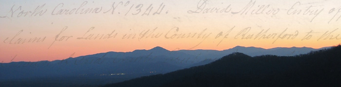
"It is adulating or swelling country, preserving fertile hills of gentle declivity and the most rich and luxurious flats or bottom lands..." —Early advertisement for lands in Western North Carolina The Speculation Lands boundaries covered territory lying east of the Blue Ridge and embraced lands lying within the present-day boundaries of Anson, Buncombe, Henderson, Polk, Rutherford, McDowell, Catawba, Cleveland, Gaston, Mecklenburg, and Union Counties. The Speculation Land Company, in advertising lands in Western North Carolina took advantage of the region’s beauty with promise and optimism. Augustus Sackett portrayed the area on a series of large printed dodgers or handbills, which were handed out and mailed from New England to Georgia. "For sale 400,000 acres of land in Rutherford, Mecklenburg, and Buncombe...not inferior in any respect to the Alabama or any other district of the county of the U.S." To a frontiersman, land speculators meant an eastern capitalist who purchased large quantities of newly offered land in anticipation of settlers to arrive. Those who sought land for investment rather than for a farm home were called land speculators. Western North Carolina was portrayed as a State where the utmost progress in civilization had been made, where infrequent industrial possibilities awaited the prospective inhabitants, and where an extensive diversification of farming offered unimaginable opportunity. The Allegheny mountain chain that stretches form Georgia northward through Maine dominates the Western North Carolina landscape. In this immense chain the ranges form Georgia to Virginia are known as the Appalachian or Southern Highlands. Here the ranges boast their loftiest peaks. At 6,684 feet, Mount Mitchell claims the title as the highest peak east of the Mississippi river. Over one hundred twenty-five mountains have an elevation greater than 5,000 feet. According to Ora Blackmun, the mountain region has been one of “nature's thickly populated zoos” with food sources and numerous streams. Daily life in Western North Carolina was hard. Living far from larger urban areas, residents of the region had little in common with the seafaring and shipping areas situated on the coast. With virtually no opportunity for outside contacts, these mountain people were by-passed by the advancement that came to other areas. Pockets of neighbors and relatives made up the reticent world of cove and mountain families, walled in by the splendor of the towering mountains. Transportation had already become recognized as the major problem in the development of the region. Roads were virtual trails, remnants from the days of Indian occupation. The eventual opening of turnpikes would broaden their influence and created better economic possibilities. The Broad, First Broad, Second Broad Rivers as well as the Green River provided routes for trade. Additionally, the farms were self-sustaining with their owners able to manufacture everything they needed and purchasing only a bare minimum. |
|
Discovery of Gold in Western North Carolina |
"The whole country was fired with enthusiasm; miners flocked into the state from the four corners of the earth, and any tract of land which showed a trace of gold was grabbed up." —Sadie Smathers Patton Gold was discovered in Little Meadow Creek in Cabarrus County in 1799, which borders Mecklenburg County to its south. Soon other mines began operations and prospecting proved fruitful. These events were to have important repercussions for the State and the Nation, because they focused attention on the region and resulted in this county's first gold rush. Elias Boudinot, Director of the United States' Mint, in 1804 called the attention of President Thomas Jefferson to the recent events - events that would mean so much to the struggling young Nation which theretofore had depended solely upon foreign countries as its sources of gold. The formation of the North Carolina Gold Mining Company immediately initiated operations. Prior to 1829 all of the native gold used by the United States mint came form North Carolina. In fact, Charlotte, situated in Mecklenburg County, is built on top of two abandoned gold mines. Few deposits of gold were verified west of the real mining area. New gold discoveries continued and mines opened in thirteen counties. Consequently, those in Burke and Rutherford were so prosperous that by 1825, these counties were the scenes of the nation's most lucrative gold mining operations and gave North Carolinas its early name, The Golden State. It was the Bechtler Mint that coined most of the gold mined on the Speculation Lands. The Speculation Land Company always reserved mineral interests in deeds when their land was sold, for they hoped to make great fortunes from the gold mines known to exist throughout the region (see 0026, 0111, 0134, 0321, 0452, 0545). |
|
Immigration into Western North Carolina |
| From the seventeenth to the nineteenth centuries European immigrants,
many
of them from classes denied the right to land ownership, carried with
them to America an appetite for Land. This
was the motivating factor, which sent hordes of settlers into the expanding
frontier and brought forth large sums of money for investment in America’s
unsettled areas. With further treaties with the Cherokee Indians, settlers came
rapidly and established homes there. The first comers to the region occupied
lands in the creek and river valleys, which extended from one to four miles in
width. It was during this
period that unknown English explorers gave the Blue Ridge Mountain range its
name. Western North Carolina would
see an influx of Scottish-Irish immigrants who arrived primarily along the Great
Wagon Road that originated just south of Pennsylvania. A majority of the
immigrants to the region after the Revolutionary War were too poor to meet the expense of
the prices paid by land speculators. In 1790 there were 88 families in the Blue Ridge Mountains.
By 1800 there were 888 families, and 43% of the population was Scotch-Irish. Many surnames throughout the Speculation Lands Collection
bespeak Scotch-Irish heritage.
Next page: Timeline |
|
Bibliography: ( See also Bibliography for a more extensive list) |
|
Blackmun, Ora. Western North Carolina : its mountains and its people to 1880. Appalachian Consortium Press, Boone, N.C., 1977. Blethen, Tyler and Curtis W. Wood Jr. From Ulster to Carolina: The Migration of the Scotch-Irish to Southwestern North Carolina. Raleigh: NC Dept. of Cultural Resources, 1998. Camp, Cordelia. The Influence of Geography Upon Early North Carolina. Raleigh: Carolina Charter Tercentenary Commission, 1963. Gates, Paul Wallace. "The Role of the Land Speculator in Western Development." Pennsylvania Magazine of History, vol. 6, 314-333, 1942. Patton, Sadie Smathers. Buncombe to Mecklenburg-Speculation Lands. Forest City NC: The Forest City Courier, 1955. ———. Sketches of Polk County History. Asheville: Miller Printing Co., 1950. ———. The Story of Henderson County. Asheville: Miller Printing Co., 1947. State Library of North Carolina. "Reeds Gold Mine," n.d. (24 May 2004). Van Noppen, John and Ina. Western North Carolina since the Civil War. Boon, N.C.: Appalachian Consortium Press, 1973. Young, Perry. "The original gold rush was right here in North Carolina." Asheville Citizen Times, August 21, 1998. |