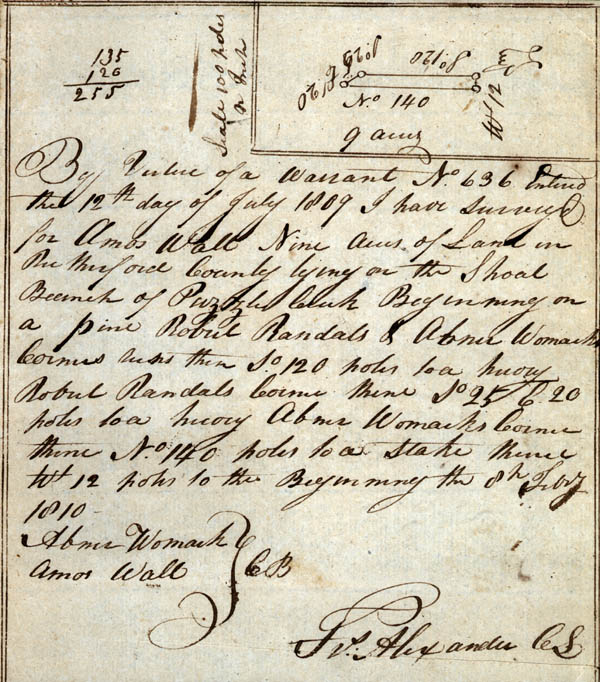
Note: Map of tract of
land in top right corner
Scale 100 poles an Inch
By Virtue of a Warrant No. 636 Entered the 12th day of July 1809 I have surveyed for Amos Wall Nine acres of Land in Rutherford County lying on the Shoal Branch of Puzzle Creek Beginning on a pine Robert Randal's & Abner Womack's Corner runs [?] then So. 120 poles to a hickory [?] Robert Randal's Corner thence So. 25 E. 20 poles to a hickory Abner Womak's Corner thence No. 140 poles to a stake thence Wt. 12 poles to the Beginning the 8th Febry. 1810
Abner Womack
Amos Wall CB [Chain Bearers]
Frs. Alexander CS [County Surveyor]