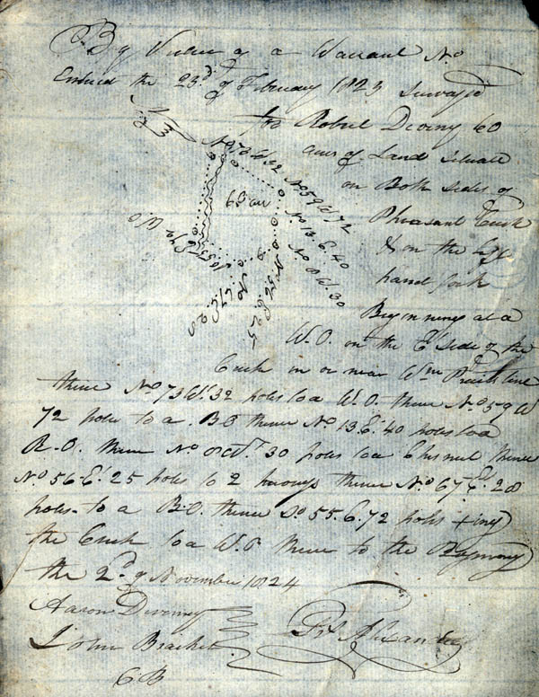
By Virtue of a Warrant
No. Entered the 23d of February 1823 Surveyed for Robert Durny
60 acres of Land situate on Both sides of Pheasant Creek & on the
left hand fork Beginning at a W.O. [white oak] on the E.' side of
the Creek in or near Wm. [William] Pruit's line thence No. 73 W.' 32
poles to a W.O. thence No. 59 W. 72 poles to a B.O. [black oak]
thence No. 13 E. 40 poles to a B.O. thence No. 8 Wt. 30 poles to a
Chestnut hence No. 56 Et. 25 poles to 2 hickories thence No. 67 Et.
28 poles to a B.O. thence So. 55 E. 72 poles xing [crossing] the
Creek to a W.O. thence to the Beginning the 2d of November 1824
Aaron Durney
John Bracket [?]
Frs. Alexander
CB [Chain Bearers]
Aaron Durney
John Bracket [?]
Frs. Alexander
CB [Chain Bearers]