Note: Map of tract of
land on right side of document
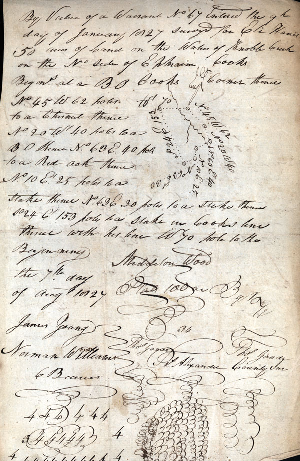
By Virtue of a Warrant No. 67 Entered the 9th day of January 1827 surveyed to Eli Hanes 50 acres of Land on the Waters of Knobb Creek on the No. side of Ephraim Cook's Begin. [Beginning] at a B.O. [Black Oak] Cook's Corner thence No. 45 W. 62 poles to a Chestnut thence No. 20 Wt. 40 poles to a B.O. thence No. 63 E. 40 poles to a Red Oak thence No. 10 E.' 25 poles to a stake thence No. 63 E. 30 poles to a stake thence So. 24 E.' 153 poles to a stake in Cooke's line thence with his line W. 70 poles to the Beginning
the 7th day of Aug. 1827
James Young
Norman Williams Frs. Alexander County Sur. [Surveyor]
C Bearers [Chain Bearers]
Note: Map of tract of land in the left top corner
By Virtue of a Warrant No 54 Entered the 15th
Decbr. 1826 surveyed for Middleton Wood 100
acres of Land on the No. side of Green River Begin. [Beginning] at a Cucumber tree on the River Bank at the Mouth of a Branch Lacheriah Wood's old Corner thence with Sd [said] line No. 74 E. 52 pole to a B.O. [black oak] his Corner thence with another line No. 20 Et. 110 poles to a stake on sd [said] line thence So. 70 Et. 100 poles to a B.O. by the Branch West side about 50 yards above the Big Rock thence So. 60 poles to a stake thence So. 20 Wt. 60 poles to a stake in John Moore's line thence with his line No. 85 Wt. 160 poles to a stake on the River Bank thence with the River No. 20 poles to the Beginning the 30th of June 1827
Aaron Fowlar Frs. Alexander
Randolph Wood
C Bearer [Chain Bearers]