By Virtue of a Warrant
No.
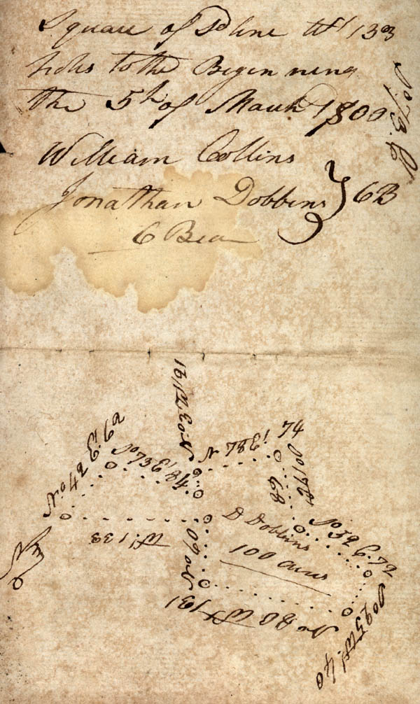
Surveyed for Drusy[?] Dobbins one hundred acres of land lying the waters of Collins Mill Creek Beginning on a P.O. [post oak] on Daniel Webb's line running then No. 42 E' 62 poles to a [?] Webb's Corner thence with Webb's line So. 73 E' 84 pole to a P.O. by Webb's Corner thence3 No. 3 W. 21 poles to a P.O. on sd [said] line thence No. 78 Et. 74 poles to a pine thence So. 17 E. 68 poles to a pine thence So. 52 Et. 72 poles to a hickory sapling thence So. 25 W. 40 poles to a pine thence No. 80 Wt. 131 poles to stake on his own line thence N. 60 poles to a Red Oak his old Corner thence with another square of sd [said] line W' 133 poles to the Beginning the 5th of March 1800
William Collins
Jonathan Dobbins
C Bear [Chain Bearers]