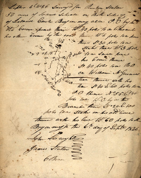
Note: Map of tract of
land on the left side of the page
Sept. 6 1826 surveyed for Reuben Staton 50 acres of Land situate on Both sides of Island Creek Beginning at a P.O. [post oak] by his old Corner pine thence W. 40 poles to a Chestnut his other Corner by the road thence Et. 6 poles to a pine thence So. 30 poles to a stake thence W' 3 poles to a small pine his Corner thence So. 40 poles to a B. O. [black oak] on William McGuinne's line thence with his line So. 40 E. 60 poles to a P.O. thence No. 55 E' 40 poles to a W.O. [white oak] by a thd[?] Branch thence No. 20 E. 100 poles to a stake on his old fence thence with this line W. 60 poles to the Beginning the 6th day of Septr. 1826
John Laughter
James Staton
C Bear [Chain Bearers]