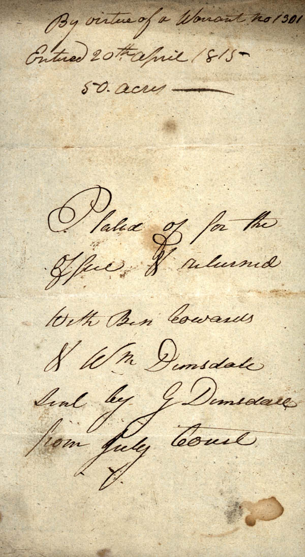
Surveyed for
George Dimsdale fifty acres of Land situate on both sides of
Potter's Creek Joining line of W. Dimsdale beginning at a large
White O. [oak] on the W. bank of the Creek thence N. 52 W. 34 p
[poles] to a W.O. then N. 25 E. 120 p [poles] to a B.G. then S. 50
E. 28 p to a P.O. then s. 25 E. 62 p to a pine, then S. 32 poles to
a B.O. [black oak] then S. 53 W. 40 p to a S. then W. 40 p. to the
beginning 10th May 1816
Benj. Coward
W. Dimsdale C.B. [Chain Bearers]
W. Alexander
Benj. Coward
W. Dimsdale C.B. [Chain Bearers]
W. Alexander