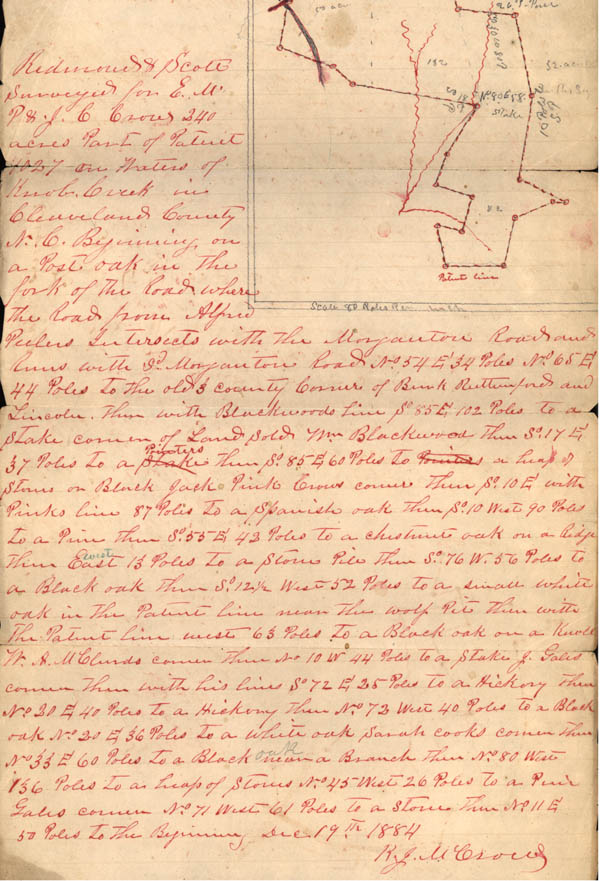
Redmond Scott
Surveyed for E.M.
P. & J.C. Crowe 240
acres part of Patent
1027 on Waters of
Knob Creek in
Cleveland County
N.C. Beginning, on
a Post oak in the
fork of the Road where
The Road from Alfred
Peelers Intersects with the Morganton Road and
Runs with So. Morganton Road No. 54 E. 34 Poles No. 65 E.
44 Poles to the old 3 county corner of Bunk...Rutherford and
Lincoln. Then with Blackwoods Line So. 85 E. 102 Poles to a
stake corner of Land Sold Mr. Blackwood Then So. 17 E.
37 Poles to a Pointers then So. 85 E. 60 Poles to a heap of
stones on Black Jack Pink Crows corner thence So. 10 E. with
Pinks line 87 Poles to a Spanish Oak then So. 10 West 90 Poles
to a Pine then So. 55 E. 42 Poles to a chestnut oak on a Ridge
then West 13 Poles to a Stone Pile then So. 76 W. 56 Poles to
a Black oak then So. 12 1/2 West 52 Poles to a small white
oak in the Patent Line near the wolf pit then with
the Patent Line west 63 poles to a Black oak on a knoll
Mr. A. McClouds corner then So. 10 W 44 Poles to a Stake J. Gales
corner then with his line So. 72 E. 25 Poles to a Hickory then
No. 20 E. 40 Poles to a Hickory then No. 72 West 40 Poles to a Black
oak No. 20 E. 36 Poles to a white oak Sarah Cooks corner then
No. 33 E. 60 Poles to a heap of stones No. 45 West 26 Poles to a Pink
Gales corner No. 71 West 61 Poles to a Stone then No. 11 E
50 Poles to the beginning. Dec. 19th 1884.
K.J. M. Crowe