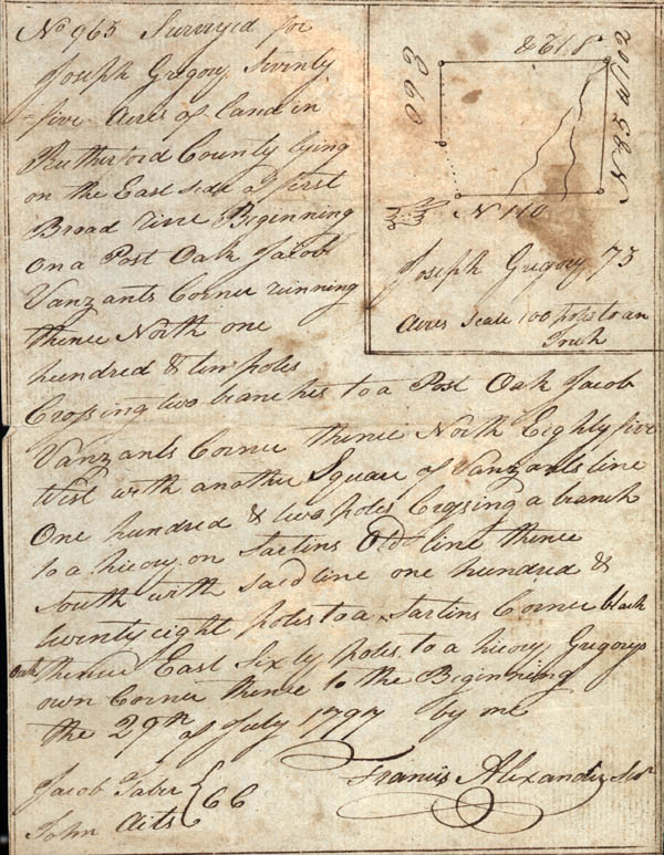
No 965 Surveyed for
Joseph Gregory seventy five acres of land in Rutherford County lying
on the East side of first Broad River. Beginning on a Post Oak Jacob
Vanzants Corner running thence North one hundred & ten poles
Crossing two branches to a Post Oak Jacob Vanzants Corner thence
North Eight five West with another Square of Vanzants line One
hundred & two poles crossing a branch to a hickory[?] on Saetins old
line thence south with said line one hundred & twenty eight poles to
Saetins Old line thence South with said line one hundred & twenty
eight poles to a Sartins Corner black oak thence East sixty poles to
a hickory Gregorys own Corner thence to the Beginning the 29th of
July 1797 by me
Jacob Taber
John Aits [Chain Bearers]
Francis Alexander Sur [Surveyor]
[Backside]
October 31st 1797 Surveyd for James Blackburn 100 acres of land on the E side of Grog Creek Beginning on a line thence E 107 poles to a line thence No 180 poles to a pine thence W 90 poles to a stake in Hauses[?] line thence with line So 148 poles to a red oak Hauses old corner thence W 17 poles to a stake thence to the Beginning
Polk[?] Eperson
George Rollens