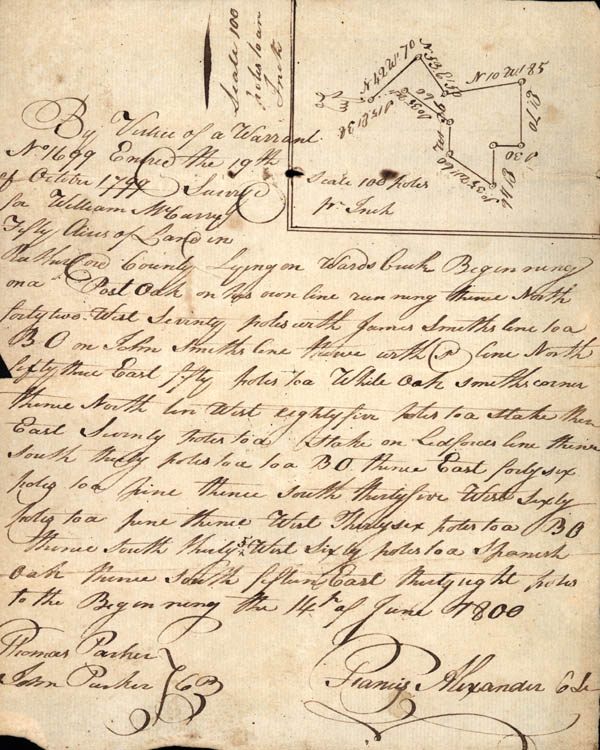
By Virtue of a Warrant
No 1699 Entered the 19th of October 1799 Surveyed for William
McCurry Fifty acres of Land in Rutherford County lying on Wards
Creek Beginning on a Post Oak on his own line running thence North
forty two West seventy poles with James Smiths line to a BO on John
Smith's line thence with line North fifty thence East fifty poles to
a White oak smiths corner thence North ten West eight five poles to
a stake then East seventy poles to a BO thence East forty six poles
to a pine thence south thirty five West sixty poles to a pine thence
West Thirty six poles to a BO thence south thirty 5 West sixty poles
to a Spanish Oak thence South fifteen East thirty eight poles to the
beginning the 14th of June 1800
Thomas Parker
John Parker [Chain Bearers]
Francis Alexander CSr [County Surveyor]
Thomas Parker
John Parker [Chain Bearers]
Francis Alexander CSr [County Surveyor]