[First Survey]
No 1074 April 19th 1798 surveyed for John Miller 200 acres of land lying on the No fork of Dunian's[?] Creek Beginning on a Black Oak on his own line then with his line N 59 W 124 poles crossing a Branch to a W.O. his old corner then with an other square of S. line N 31 E 22 poles crossing a Branch to a stake on his other line then with S line N 84 W. 38 poles to a W Oak where we[?] supposed an old corner of John Whitesides road[?] then with line S 88 W 138 poles to a BO and Side lin & in or near Daniel Miller's line then S 15 E 86 poles to a sourwood then S 62 W 80 poles crossing a branch to a line on the top of a Mountain then No 52 W 36 poles to a Black Jack then So 40 poles to a Hickory then N 80 E 137 poles +ing a Branch to a stake on Samuel Carter line then wik[?] Side line N 25 E 16 poles to a pine Carters Corner then with an other square of his line E 60 poles to a pine then N 20 poles to a Chesnut Oak Carter's Corner then E 135 poles to a pine Millers own P[?] corner then N 40 poles to the Beginning.
John Fortune
Silas Milton [Chain Bearer]
[Second Survey]
By a warrant Ented the 30th day of January 1797
N 1072 Surveyed for John Milton 33 acres of Land Lying on Cariome's[?] Branch of first Broad River Beginning on a Spanish Oak on his own line & on Josephs graysons line running then with Grayson's line 59 E 68 poles crossing the Branch to a Spanish oak by Graysons corner stake then with another sqr of [property] line N 31 E 100 poles +ing a Branch to a pine on graysons in & on the speculators line then with the Spc. ors line So 160 poles +ing a Branch to a hickory the speculators corner then So 60 at 9 poles to a W.O. on Millers line then with his line N 48 poles to a pine D Millers corner then west with line 32 poles to a stake & pointers on Miltons own line then with line N 21 poles to a PO then N 69 W 24 poles to a line on his own old line then with S line 88 W 66 poles +ing the [...?] is to a line on his other line then with line N 38 E 38 [?] The beginning the 19th[?] 1798
John Fortune
Silas Miller [Chain Bearers]
[Third Survey]
No 1484 April the 23rd 1798 Surveyed for Adam Whitesides 200 acres of Land lying on the No fork of little Broad river Beginning on a Black oak the W side of the fork and on the E side of a Mountain running then N 140 poles to a pine then Et 140 poles crossing the Fork[?] to a stake then Et 140 South 17 Et 200 poles to a stake then South 56 poles to a stake in Samuel Nortons and [whou...?] now lines with sd line N 61 Wt 223 poles crossing the fork &passing his old Beginning Corner to the Beginning
Thomas Stockton Esqr
Ellis Webb [Chain Bearers]
Their worth is to be transfered
to Samuel Stockton &
to be returned to Carpenter
[Fourth Survey]
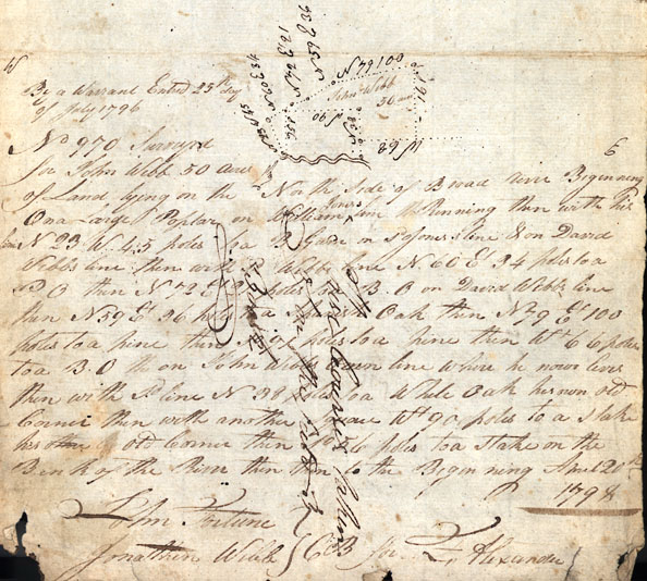
By a Warrant Entered 25th day of July 1796
No 970 Surveyed for John Webb 50 acres of Land lying on the North Side of Broad river Beginning On a large Poplar on William Jones line Running then with his line N 23 W. 45 poles to a B Gum on Sd {side] of Jones's line & on David Webb's line then with sd Webbs line N 60 Et 34 poles to a P.O then N 72 E 21 poles to a B.O. on David Webbs line then N 59 Et 36 poles to a Spanish Oak then N 79 Et 100 poles to a pine then So 91 poles to a pine then Wt 66 poles to a B.O. on John Webbs own line where he now lives then with sd. line N 38 poles to a White Oak has own old corner then with another square Wt 90 poles to a stake his other Old corner then So 56 poles to a stake on the Bank of the River then then to the Beginning April 12th 1798
John Fortune
Jonathan Webb [Chain Bearers]
For F. Alexander
No 1074 April 19th 1798 surveyed for John Miller 200 acres of land lying on the No fork of Dunian's[?] Creek Beginning on a Black Oak on his own line then with his line N 59 W 124 poles crossing a Branch to a W.O. his old corner then with an other square of S. line N 31 E 22 poles crossing a Branch to a stake on his other line then with S line N 84 W. 38 poles to a W Oak where we[?] supposed an old corner of John Whitesides road[?] then with line S 88 W 138 poles to a BO and Side lin & in or near Daniel Miller's line then S 15 E 86 poles to a sourwood then S 62 W 80 poles crossing a branch to a line on the top of a Mountain then No 52 W 36 poles to a Black Jack then So 40 poles to a Hickory then N 80 E 137 poles +ing a Branch to a stake on Samuel Carter line then wik[?] Side line N 25 E 16 poles to a pine Carters Corner then with an other square of his line E 60 poles to a pine then N 20 poles to a Chesnut Oak Carter's Corner then E 135 poles to a pine Millers own P[?] corner then N 40 poles to the Beginning.
John Fortune
Silas Milton [Chain Bearer]
[Second Survey]
By a warrant Ented the 30th day of January 1797
N 1072 Surveyed for John Milton 33 acres of Land Lying on Cariome's[?] Branch of first Broad River Beginning on a Spanish Oak on his own line & on Josephs graysons line running then with Grayson's line 59 E 68 poles crossing the Branch to a Spanish oak by Graysons corner stake then with another sqr of [property] line N 31 E 100 poles +ing a Branch to a pine on graysons in & on the speculators line then with the Spc. ors line So 160 poles +ing a Branch to a hickory the speculators corner then So 60 at 9 poles to a W.O. on Millers line then with his line N 48 poles to a pine D Millers corner then west with line 32 poles to a stake & pointers on Miltons own line then with line N 21 poles to a PO then N 69 W 24 poles to a line on his own old line then with S line 88 W 66 poles +ing the [...?] is to a line on his other line then with line N 38 E 38 [?] The beginning the 19th[?] 1798
John Fortune
Silas Miller [Chain Bearers]
[Third Survey]
No 1484 April the 23rd 1798 Surveyed for Adam Whitesides 200 acres of Land lying on the No fork of little Broad river Beginning on a Black oak the W side of the fork and on the E side of a Mountain running then N 140 poles to a pine then Et 140 poles crossing the Fork[?] to a stake then Et 140 South 17 Et 200 poles to a stake then South 56 poles to a stake in Samuel Nortons and [whou...?] now lines with sd line N 61 Wt 223 poles crossing the fork &passing his old Beginning Corner to the Beginning
Thomas Stockton Esqr
Ellis Webb [Chain Bearers]
Their worth is to be transfered
to Samuel Stockton &
to be returned to Carpenter
[Fourth Survey]
By a Warrant Entered 25th day of July 1796
No 970 Surveyed for John Webb 50 acres of Land lying on the North Side of Broad river Beginning On a large Poplar on William Jones line Running then with his line N 23 W. 45 poles to a B Gum on Sd {side] of Jones's line & on David Webb's line then with sd Webbs line N 60 Et 34 poles to a P.O then N 72 E 21 poles to a B.O. on David Webbs line then N 59 Et 36 poles to a Spanish Oak then N 79 Et 100 poles to a pine then So 91 poles to a pine then Wt 66 poles to a B.O. on John Webbs own line where he now lives then with sd. line N 38 poles to a White Oak has own old corner then with another square Wt 90 poles to a stake his other Old corner then So 56 poles to a stake on the Bank of the River then then to the Beginning April 12th 1798
John Fortune
Jonathan Webb [Chain Bearers]
For F. Alexander