[side One]
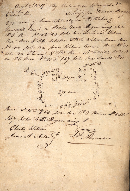
Augt. 2d 1819 By virtue of a Warrant No [Blank] Entered the [Blank] surveyd for David Boyse 271 acres of Land Situate on the Waters of Howards Creek [or?, on?] Hookers Creek Beginning at a P.O. thence No. 10 W 84 poles to a stake on Wilsons line thence Et 34 poles to a stake on Wilsons Corner thence No. 155 poles to a pine Wilsons Corner thence Wt 51 poles to a Chesnut & P.O. thence No. 10 W. 32 poles to a P.O. thence No 80 Et 167 poles to a small PO thence So. Et 260 poles to a P.O. thence So. 30 Wt 167 poles to the Beginning
Charles Wilson
James A Miller [Chain Bearers]
Frs. Alexander
[Side Two]
Augt. 3d 1819 Surveyd for Nancy Wilsons Creek Beginning at a [f...e?] on the Et. Side the Creek thence No 43 Wt 180 pole to a pine thence No. 47 Et 104 poles to a W.O. on {Dus?] line thence with D line Et. 190 poles to a B.Oak in Kyconnets line thence So. 47 Wt. 180 poles to the Beginning
Charles Wilson
Isam Ponder [Chain Bearers]
