[Both sides contain
same Warrant]
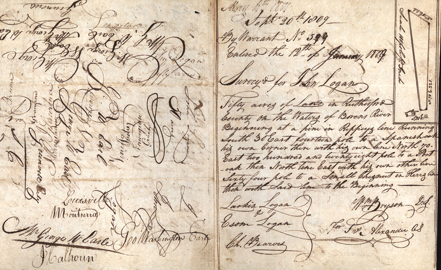
Sept. 20th 1809
By Warrant No. 399
Entered the 12th of January 1809
Survey for John Logan
Fifty acres of land in Rutherford County on the Waters of [Borens?] River Beginning at a pine in Rippeys line Runing South 30 East fourteen pole to a Spanish oak his own Corner then with his own line North 70. East two hundred and twenty eight pole to a Post oak then North ten East with his own other line Sixty four pole to a Small Chesnut on Herrs line then with said line to the Beginning
Larkin Logan
Esom Logan [Chain Bearers]
Wm Bryson D.S.
for Rr Alexander CS
Ch. Bearers