Transcription:
Page 1
|
|
| |
Courses and distances
of survey No. 2 on the waters of Flat Creek. Hickory nut Creek and Main
Broad River. Part of Par. No. 1016 in McDowell and Henderson Counties,
bounded by Johnson Ashworth's [?] and others. Beginning at a fallen down
locust between two large rocks, at or near the top of the Blue Rock, at
a corner of Johnson Ashworth's large survey and runs with Ashworth's
line S. 8º E / 8.25
to a Dog-wood.
S. 8º E / 8.25 |
| S. 65º W. 950
|
Then S. 65º W. 950 to a
Locust his corner |
| S. 42º E. 5776
|
Then S. 42º E. 5776 to a Chest on South side of a branch. |
| S. 70º W. 3075
|
Then S. 70º W. 3075 to a heap of stones his corner of 50 acres. |
| South 400
|
Then with a line of 50 acre tract South 400 to a heap of stones in said line Thomas Ledbetter's corner. |
| East 2900
|
Then with his line East 2900 to a stone his corner. |
| South 1500
|
Then South 1500 to a R.O., B. Sherril's corner of Ala [?] cabin. |
| East 2500
|
Then with Sherril's line East 2500 a stake. |
| South 4000 |
Then South 4000 to a stake in Nik's [Nite's?] line. |
| |
|
Transcription:
Page 2
|
|
| East 675
|
Then with Nite's [Nik's?] line
East 675 to a C.O. his corner. |
| South 31.75 |
Then South 31.75 to stake his corner. |
|
West 31.75 |
Then West 31.75 to a Water oak on west side of mountain cor. |
|
North 31.75 |
Then North 31.75 to a B. Gum Sherril's corner. |
|
North 2500
|
Then with Sherril's line North 2500 to a Locust Ledbetter's
corner. |
| S. 77º W. 31.50
|
Then with Ledbetter's line S. 77º W. 31.50 to a Black Gum James
Toms' Beginning corner. |
S. 16º E. 2250
|
Then with Tom's line S. 16º E. 2250 to a Chest. Oak his corner
and William Huntley's[?]. |
| East 9.25 |
Then with Huntley's line East 9.25 to a S.O. his corner. |
| South 5000
|
Then South 5000 to a Hr. Larkino[?] Freeman's corner. |
| S. 62º E. 2800
|
Then with Freeman's line S. 62 E. 2800 to a stake his corner. |
| South 2750
|
Then South 2750 to a Chestnut in a hollow his corner. |
| N. 66º W. 2475 |
Then N. 66º W. 2475 to a Spruce Pine his corner. |
|
S. 78º W. 900
|
Then S. 78º W. 900 to a W.O. on the bank of a creek. |
| N. 72º W. 1500 |
Then N. 72º W. 1500 to a Dogwood below [continued on image 3] |
| |
|
Transcription:
Page 3 |
|
| |
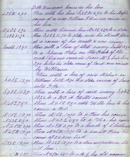
[continued from image 2]
D.B. Freeman's house in his line. |
|
S. 25º W. 650
|
Then with his line S. 25º W. 650 to his Maple corner at or near
William G. Conner's corner on his line. |
| N. 65º E. 875
|
Then with Conner's line N. 65º E. 875 to a stake. |
| S. 25º E. 3176
|
Then S. 25º E. 3176 to stake near his old mill place at a corner
of his small 5 acre survey. |
| South 1250
|
Then with a line of that survey
South 1250 to a Spruce Pine on the Bank of the creek Conner's
comes in Isaac Mcabee's line 700
below his stake corner of land once owned by Williams. |
| S. 40º E 1300 |
Then with a line of said Mcabee's or Williams
S. 40º E 1300 to a stake corner of land sold D.B. |
|
S. 40º E. 1225
|
Then with a line of said survey S. 40º E. 1225 to a W.O. A Hill's
corner. |
| S. 60º E. 950
|
Then S. 60º E. 950 with Hill's line to his corner a R.O. |
| N. 10º E. 1000
|
Then N. 10º E. 1000 to a Pine his corner. |
| N. 60º E. 550
|
Then N. 60º E. 550 to a Hr. his corner. |
N. 63º W. 1900
|
Then N. 63º W. 1900 o a small Pine his corner of 25 acre tract. |
N. 23º E. 1800
|
Then N. 23º E. 1800 to a stone and pointers[?] in his old
line. |
| N. 47º W. 350 |
Then N. 47º W. 350 to a B.G. his old corner. |
| |
|
Transcription:
Page 4 |
|
| S. 80º E. 2700
|
Then S. 80º E. 2700 to a
stone in said line William Williams corner. |
| N. 17º E. 4000
|
Then with William's line N. 17º E. 4000 to a stone by a R.G. and
maple in a hollow. |
| N. 85º E. 2500
|
Then N. 85º E. 2500 crossing the river to a stake Williams corner. |
| S. 17º W. 4250
|
Then S. 17º W. 4250 crossing the river to a Spruce Pine Williams
beginning[?] corner on the west bank of the river at the mouth of the
Bear Branch. |
| S. 74º W. 750
|
Then with William's S. 74º W. 750 to a large Chestnut Allen
Hill's corner. |
| S. 8º E. 4100
|
Then with Hill's S. 8º E. 4100 to a stake his cor. |
| S. 43º W. 3600
|
Then S. 43º W. 3600 to a Spruce Pine William's corner. |
| S. 68º W. 450
|
Then with William's line S. 68º W. 450 to a maple at the ford of
Hickory but, John Casey's corner of his 500 acre survey. |
| N. 68º E. 5850
|
Then with his line N. 68º E. 5850 crossing the river to a Poplar
his corner at the Woff[?] fren gap. |
| N. 8º W. 3750
|
Then to a line not of any tract of land N. 8º W. 3750 to a poplar
John Hudgin's corner. |
| N. 16º E. 2500 |
Then with Hudgin's line N. 16º E. 2500 to a stake in said line
Richard Hudgin's corner if land surveyed by Riggerslaff. |
| |
Then with a line of said survey N. 76º W. 550 to a stake and
pointers. |
| |
|
Transcription:
Page 5 |
|
| S. 42º E. 6500
|
Then S. 42º E. 6500 to a
stake at or near cor. of Pat. |
| S. 48º W. 500
|
Then S. 48º W. 500 to a stake corner. |
| S. 65º E. 5375
|
Then S. 65º E. 5375 to a B.G. cor. of the Pat. |
| S. 25º W. 2000
|
Then S. 25º W. 2000 to a B.O. in a gap on top of the diverting
ridge between Grant's Creek and Turkey Otter and nearby west of the Oak
mountain, about 175 Southwest of J.W. Morgan's corner. This oak
is on a little nole (sic) and is broken. |
| N. 57º W. 175
|
Then N. 57º W. 175 to a B.O.J. Morgan's corner and a corner of
Pat. |
| S. 35º W. 1825
|
Then with pat. line S. 35º W. 1825 to a stake in said line, Isaac
Bradley's corner on said line. |
| N. 75º W. 5200
|
Then with his line N. 75º W. 5200 to a Chestnut Bradley's corner. |
| S. 45º W. 2200
|
Then S. 45º W. 2200 to a Pine his corner. |
| S. 15º E. 675
|
Then S. 15º E. 675 to a S.O. on a ridge. |
| S. 75º E. 1775
|
Then S. 75º E. 1775 to a P.O. in said line J. Morgan's corner of
his new survey. |
| S. 65º W. 1350
|
Then with Morgan's[?] line S. 65º W. 1350 to a B.O. Morgan's
corner. |
| N. 70º W. 2550
|
Then N. 70º W. 2550 to a Hickory |
| West 850
|
Then West 850 to a S.O. |
| N. 42º W. 400
|
Then N. 42º W. 400 to a W.O. |
| N. 10º W. 800
|
Then N. 10º W. 800 to a hickory. |
| N. 65º W. 2150
|
Then N. 65º W. 2150 to a B. Gum. |
| S. 80º W. 750 |
Then S. 80º W. 750 crossing Turkey Otter to a W.O. |
| |
|
Transcription:
Page 6 |
|
| S. 19º W. 2650
|
Then S. 19º W. 2650 to a
stake and pointers. |
| S. 66º E. 450
|
Then S. 66º E. 450 to a
stake in his old line. |
| S. 29º W. 1100
|
Then S. 29º W. 1100 to a
Chestnut. |
| S. 65º E. 3250
|
Then S. 65º E. 3250 to a
stake his corner. |
| S. 50º E. 1700. |
Then S. 50º E. 1700 to a
B. Gum. |
|
S. 65º E. 1500
|
Then S. 65º E. 1500 to a
Span.[?] Oak. |
| N. 82º E. 2000
|
Then N. 82º E. 2000 to a
C.O. corner of Pat. on the top of a ridge between Turkey Otter and Cedar
Creek and west of a high knob. |
| S. 64º W. 3875
|
Then with a line of Pat. S. 64º
W. 3875 to a stake in Noblet's line. |
| N. 20º W. 125
|
Then with Noblet's line N. 20º
W. 125 to a maple and sourwood corner. |
| S. 60º W. 1375
|
Then S. 60º W. 1375 to a
stake. |
| N. 20º W. 1825
|
Then N. 20º W. 1825 to a
S.O. |
| S. 65º W. 1750
|
Then S. 65º W. 1750 to a
S.wood. |
| N. 74º W. 500
|
Then N. 74º W. 500 to a
stake corner. |
| S. 20º E. 2250
|
Then S. 20º E. 2250 to a
poplar in Pat. line. |
| S. 64º W. 750
|
Then with the Pat. line S. 64º
W. 750 to a stake in J.L. Whiteside's line. |
| N. 65º W. 800 |
Then with his line N. 65º W. 800
to stk. his cor. |
| N. 7º W. 3050
|
Then N. 7º W. 3050 to a
Chestnut. |
| S. 5º E. 750 |
Then S. 5º E. 750 to a
stake J. Ramsey's cor. |
| N. 85º W. 3000
|
Then with his line N. 85º W. 3000
to stk. his cor. |
| S. 5º E. 3375
|
Then S. 5º E. 3375 to a
stake his corner. |
| S. 85º E. 3000 |
Then S. 85º E. 3000 to a
stooping B[?] Maple[?] on...
[The rest of the document is missing]
|