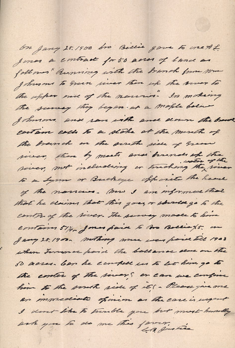
On Jany 28, 1900 [bro?] Billie gave to one A.L. Jones a contract for 50 acres of land as follows "Beginning with the branch from Wm [William?] Johnsons to Green river then up the river to the upper end of the narrows." In making the [survey?] they began at a maple below Johnson's and ran with and down the [broad?] certain calls to a stake at the mouth of the branch on the south side of Green river, then by [meets?] and [friends?] up the river, not including or tracking the water of the river to a Lynn or Buckeye opposite the head of the narrows. Now am informed that he claims that this goes, or should go to the center of the river. The survey made to him contains 51 1/4. Jones paid to Bro Billie $5, on Jany 28, 1900. Nothing more was paid till 1903 when Lawrence paid the balance and on the 50 acres. Can he compel us to let him go to the center of the river? Or can we confine him to the south side of it? Please give me an immediate opinion or the case is urgent I don't like to trouble you but most humbly ask you to do me this favor.
[signed] C. B. Justice
