[Page 2]
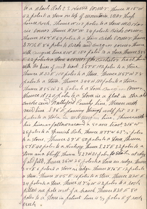
to a black oak E.S. Harris corner. Thence N 15 W 52 poles to a stone on top of mountain near sheep House Rock. Thence w 117 poles to a stone [MS Harris?] corner. Thence N 30 W 34 poles to Birds corner. Thence N 69 E 69 poles to a stone Birds corner. Thence S 71 1/2 E 86 poles to Birds and Burgers corner. Thence with Burgess line N 14 E 150 poles to a stone thence S 85 E 22 poles to a stone a corner of the Bachelor tract. Thence with the lines of said tract S 57 E 102 poles to a stone Thence N 33 E 100 poles to a stone. Thence N57 W 78 poles to a stone. Thence S44W 100 poles to a stone Thence N85 W 22 poles to a stone in a flat in the old Burke and Rutherford County line. Thence with said line S 86 E, passing through half pit 338 poles to a stake in WW [Maryaw?] line. Thence with his lines as follows around a 50 acre tract, S16 W 25 poles to a Spanish Oak. Thence N 79 W 63 2/5 poles to a stone. Thence S 9 E 50 poles to a stone. Thence S 57 E 40 poles to a Hickory. Thence S 22 e 32 poles to a stone on a bluff. Thence S27 W 31 poles to stake at edge of old field. Thence S 6 W 25 poles to a stone on ridge. Thence S 44 E 6 poles to a stone on ridge. Thence N 76 E 12 poles to a stone. Thence N 45 E 16 poles to a stone. Thence N 20 E 34 poles to a stone. Thence N 7 1/4 W 42 poles to a rock pillow one pole west of a branch. Thence N20 E 80 poles to a stone in patent line 4 2/3 poles E of rock creek.
to a black oak E.S. Harris corner. Thence N 15 W 52 poles to a stone on top of mountain near sheep House Rock. Thence w 117 poles to a stone [MS Harris?] corner. Thence N 30 W 34 poles to Birds corner. Thence N 69 E 69 poles to a stone Birds corner. Thence S 71 1/2 E 86 poles to Birds and Burgers corner. Thence with Burgess line N 14 E 150 poles to a stone thence S 85 E 22 poles to a stone a corner of the Bachelor tract. Thence with the lines of said tract S 57 E 102 poles to a stone Thence N 33 E 100 poles to a stone. Thence N57 W 78 poles to a stone. Thence S44W 100 poles to a stone Thence N85 W 22 poles to a stone in a flat in the old Burke and Rutherford County line. Thence with said line S 86 E, passing through half pit 338 poles to a stake in WW [Maryaw?] line. Thence with his lines as follows around a 50 acre tract, S16 W 25 poles to a Spanish Oak. Thence N 79 W 63 2/5 poles to a stone. Thence S 9 E 50 poles to a stone. Thence S 57 E 40 poles to a Hickory. Thence S 22 e 32 poles to a stone on a bluff. Thence S27 W 31 poles to stake at edge of old field. Thence S 6 W 25 poles to a stone on ridge. Thence S 44 E 6 poles to a stone on ridge. Thence N 76 E 12 poles to a stone. Thence N 45 E 16 poles to a stone. Thence N 20 E 34 poles to a stone. Thence N 7 1/4 W 42 poles to a rock pillow one pole west of a branch. Thence N20 E 80 poles to a stone in patent line 4 2/3 poles E of rock creek.
