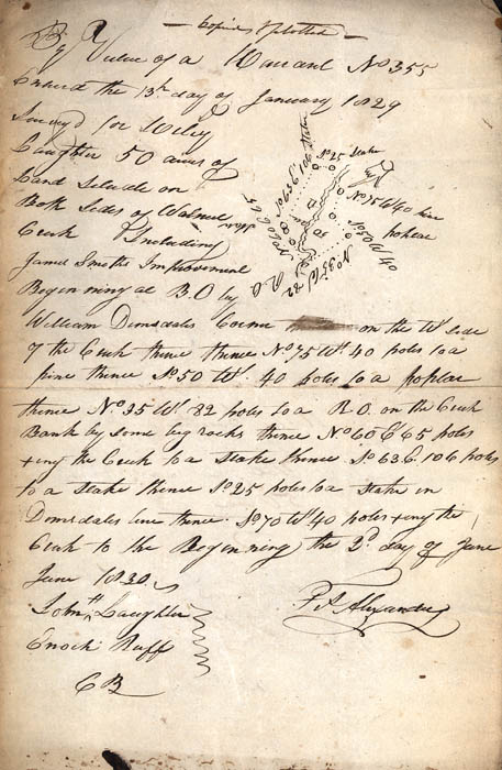
By virtue of a warrant
no. 355 entered the 13th day of January 1829 survey for Wiley
Caughlin 50 acres of land situated on both sides of Walnut Creek.
Including James Smiths Improvement beginning at B.O. [black oak] by
William Demsdale's corner on the W side pine thence South 50 West 40
poles to a poplar thence North 35 West 82 poles to a R.O. [red oak]
on the Creek Bank by some big rocks thence No. 60 East 65 poles
tiny[?] the Creek to a stake thence South 63 East 106 poles to a
stake thence South 25 poles to a stake in Demsdale's line thence
South 70 West 40 poles tiny the Creek to the Beginning, the 2nd day
of June 1830.
John Laughlin
Enoch Ruff
C.B.
F.P. Alexander
John Laughlin
Enoch Ruff
C.B.
F.P. Alexander