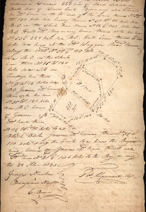
April 28, 1823. Surveyed for Robert Wells(?) without a warrant. 223
acres of land situated on both sides of Wards[?] Creek. Beginning at a
chestnut his old corner on the W. side of the Creek, thence North 55,
West 138 poles to a hickory thence South 35 West 80 poles to a B.O.
in the Spruch(?) line and thence South 12, East 160 poles to B.O.
Hull's[?] old beginning corner thence with his line South 53 East 221(?)
poles to a B.O. Hulls corner thence East 60 poles to a pine at the old
Waggon Road thence along the road North 35 East 80 poles to a B.O. in
the Spruchp[?] line then North 15 West 120 poles to a S.O. in Twilley's[?]
line then North 55 west 112 poles to a P.O. Gowen old corner thence with
his line South 35 West 120 poles to a P.O. Corner of Gowens[?] old line
thence South 82 West 80 poles to a Black Oak Gowens old Corner thence
North 55 West 110 poles, crossing the Creek to a pine the Beginning
corner of Gowens old land thence with his line North 41 East 106 poles
to the Beginning.
April 28, 1823.
George Newton [signed]
F. Alexander
Benjamin Newton
C. Bean